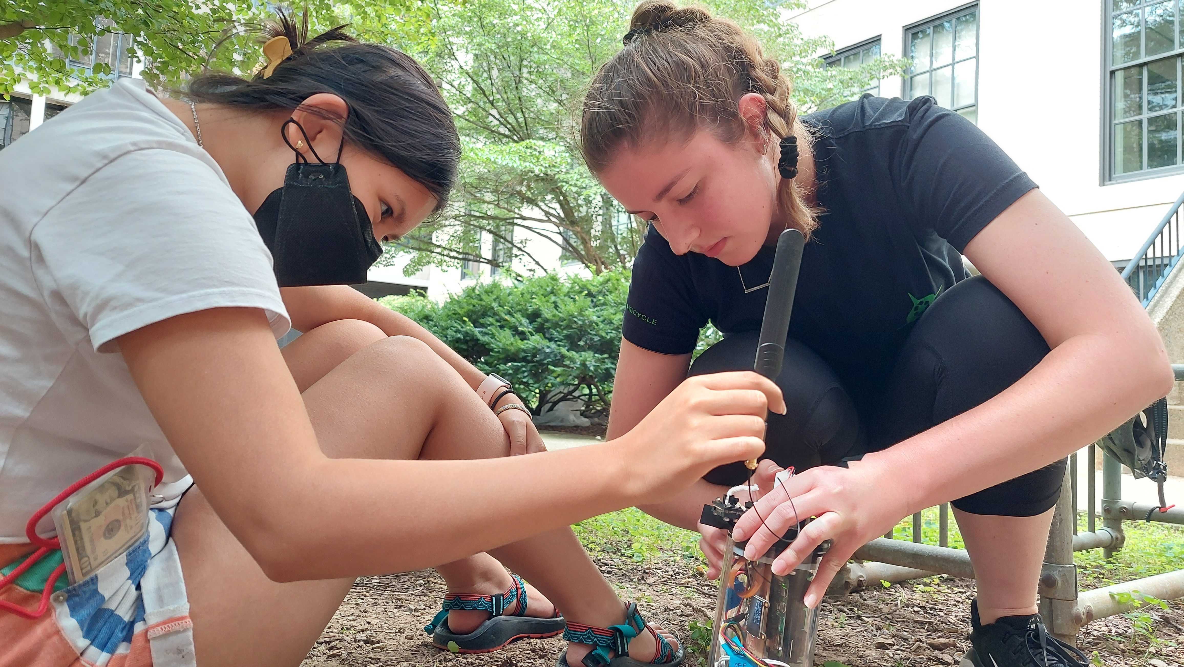
Led the mechanical design and 3D fabrication of a portable weather station, tuning enclosure tolerances to ensure a precise fit between mechanical housing and internal PCBs, sensors, and connectors, supporting modularity and ease of maintenance
Collaborated with electrical team on PCB design, soldering, and wiring, enabling seamless integration of sensors and power systems within enclosure constraints
Partnered with MIT Department of Sustainability to understand their environmental monitoring specifications and translate requirements into actionable testing protocols, validating sensor performance and cost-effective deployment strategies to meet their campus sustainability data collection objectives
Led cross-functional team of 15 through complete product development lifecycle for Gonio, an adjustable knee rehabilitation device, managing project timeline, structuring taskforces, and conducting user interviews to deliver a market-ready prototype targeting 40,000 PT clinics nationwide
Conducted comprehensive market analysis of the $9.4B total knee replacement market, identifying key pain points in post-surgical care to define product-market fit and go-to-market strategy targeting PT clinics
Presented @ ~43:34 product vision to 1,000+ live audience members (classmates, instructors, industry guests) and 10,000+ online viewers, showcasing fully functional alpha prototype

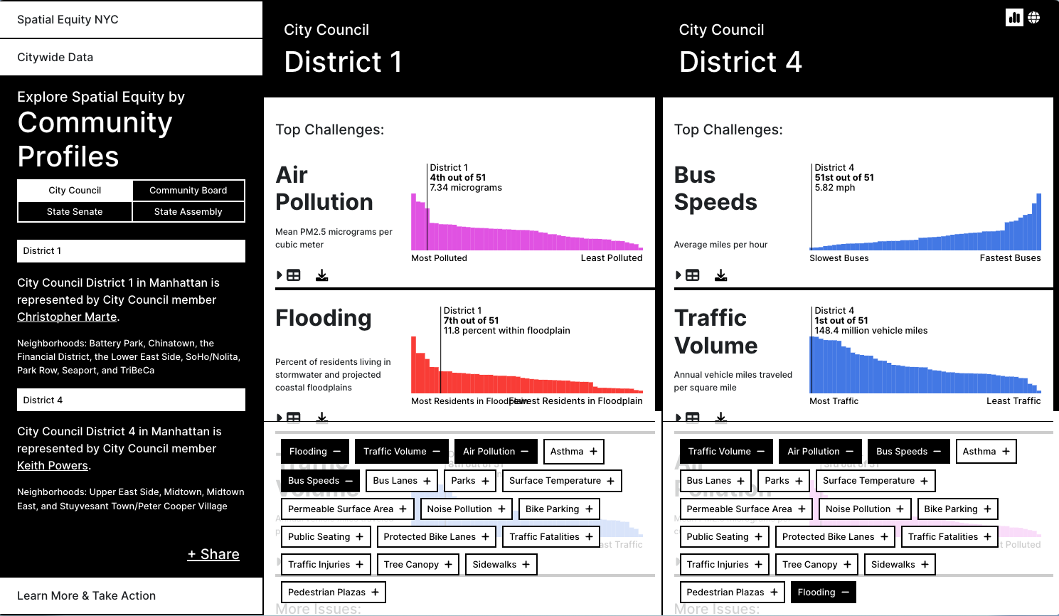
Developed a data visualization mapping application for geospatial data retrieval using React, TypeScript, MapLibre GL, and Cloudscape UI with comprehensive unit/integration testing
Implemented a dynamic data handling system that processes over 200+ GeoJSON files in real-time, resulting in a 87% increase in data fidelity compared to the current system
Evaluated and compared mapping libraries by developing mock applications, and selected the library that best fit the final application's requirements for integration and functionality
Spatial Equity NYC visualizes mobility, environment, and health data across NYC, highlighting inequities. Developed at MIT's Leventhal Center for Advanced Urbanism with Transportation Alternatives, it helps users compare neighborhoods and rankings to help advocate for safer, more sustainable transport options in NYC
Implemented data APIs requests and programmed design concepts into data visualizations for the site Spatial Equity NYC using React, Mapbox, deck.jl, and d3.js
Partnered with Transportation Alternatives and cross-functional teams to identify user needs and implement interface improvements during weekly meetings
Developed an image processing algorithm that count microbe cells in Python with a 94% accuracy rate
Developed a cell segmentation algorithm in Python to detect and isolate individual microbes in an image
Designed and built an inexpensive optimal density sensor to monitor the impact of global warming on the growth of microbes and programmed in C++ to make the system automated